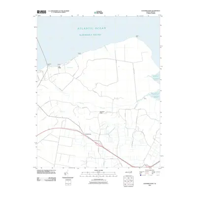
2010 Map of Leonards Point
USGS Topo · Published 2010About this map
The southern shoreline of Albemarle Sound anchors this portion of Washington County, where the low-lying coastal plain meets the water at Leonards Point and Laurel Point. The landscape is defined by its drainage network, featuring Deep Creek, Sleights Creek, and the man-made Newberry Ditch that cuts through the level terrain. Small inland settlements like Davenport Forks and Pea Ridge are connected by a grid of rural roads, including Pea Ridge Rd and Davenport Forks Rd. Along the water's edge, access points such as Newberry Landing, Shadberry Landing, and First Landing reflect a long-standing reliance on the sound for transport and livelihood. To the south, the settlement of Scuppernong sits near the primary transit corridor, surrounded by family-named landmarks like Arnold Beach Rd and Jones White Rd.
Find a feature on this map
31 named features on this map. Tap any name to fly to it.
Don’t see what you’re looking for? This feature index may not catch every label — zoom into the map to look around manually.
Map Details
Editions of this 2010 Leonards Point Map
This is the sole edition of this map. No revisions or reprints were ever made.
Other maps of this area

1904 · Edenton
USGS Topo · 1:62,500

1906 · Hertford
USGS Topo · 1:62,500

1940 · Hertford
USGS Topo · 1:62,500

1942 · Edenton
USGS Topo · 1:62,500

1943 · Columbia
USGS Topo · 1:125,000

1943 · Plymouth
USGS Topo · 1:125,000

1943 · Edenton
USGS Topo · 1:62,500

1953 · Norfolk
USGS Topo · 1:250,000

1953 · Columbia West
USGS Topo · 1:24,000

1953 · Rocky Mount
USGS Topo · 1:250,000