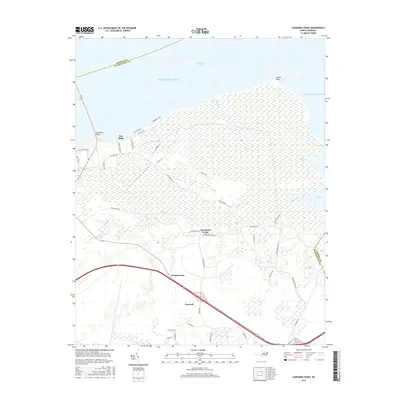
2016 Map of Leonards Point
USGS Topo · Published 2016About this map
Creswell and Scuppernong anchor the southern portion of this Washington County landscape, where the flat coastal plain of North Carolina meets the expansive waters of the Albemarle Sound. This 2016 survey illustrates a region defined by its intricate drainage and wetland systems, including the sprawling Big Swamp and Indian Swamp. The transition from the agricultural interior to the coast is marked by points such as Laurel Point and Leonards Point, which frame the opening of Bull Bay. Interior life centers around established settlements like Davenport Forks and Pea Ridge, connected by a network of rural routes such as Pea Ridge Rd and Jones White Rd. The map records specific coastal landmarks like Newberry Pitch and river access points including Deep Creek Lndg, reflecting the area's enduring relationship with the sound and its numerous creeks like Sleights Cr and Bull Cr.
Find a feature on this map
46 named features on this map. Tap any name to fly to it.
Don’t see what you’re looking for? This feature index may not catch every label — zoom into the map to look around manually.
Map Details
Editions of this 2016 Leonards Point Map
This is the sole edition of this map. No revisions or reprints were ever made.
Other maps of this area

1904 · Edenton
USGS Topo · 1:62,500

1906 · Hertford
USGS Topo · 1:62,500

1940 · Hertford
USGS Topo · 1:62,500

1942 · Edenton
USGS Topo · 1:62,500

1943 · Columbia
USGS Topo · 1:125,000

1943 · Plymouth
USGS Topo · 1:125,000

1943 · Edenton
USGS Topo · 1:62,500

1953 · Norfolk
USGS Topo · 1:250,000

1953 · Columbia West
USGS Topo · 1:24,000

1953 · Rocky Mount
USGS Topo · 1:250,000