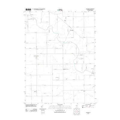
2012 Map of Leonore
USGS Topo · Published 2012About this map
The Vermilion River snakes across this Central Illinois landscape, defining the rural character of LaSalle County in the early 21st century. The village of Leonore sits on the western edge of the quadrangle, characterized by its traditional grid and the presence of Gray St. Further east, the settlement of Farm Ridge occupies the higher ground above the river valley. The region is predominantly agricultural, stitched together by a systematic grid of county roads like N 21st Rd and E 10th Rd.
Find a feature on this map
63 named features on this map. Tap any name to fly to it.
Don’t see what you’re looking for? This feature index may not catch every label — zoom into the map to look around manually.
Map Details
Editions of this 2012 Leonore Map
This is the sole edition of this map. No revisions or reprints were ever made.
Other maps of this area

1892 · Ottawa
USGS Topo · 1:62,500

1893 · Lasalle
USGS Topo · 1:62,500

1911 · La Salle
USGS Topo · 1:62,500

1913 · La Salle
USGS Topo · 1:62,500

1915 · Ottawa
USGS Topo · 1:62,500

1925 · Streator
USGS Topo · 1:62,500

1927 · Streator
USGS Topo · 1:62,500

1934 · Wenona
USGS Topo · 1:48,000

1939 · Wenona
USGS Topo · 1:62,500

1946 · Ottawa
USGS Topo · 1:62,500