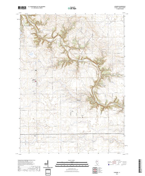
2024 Map of Leonore
USGS Topo · Published 2024About this map
The Vermilion River carves a deep, sinuous path across this LaSalle County landscape, creating a striking contrast between its wooded banks and the surrounding grid of central Illinois farmland. The settlement of Leonore serves as a primary local hub, while smaller named locales such as Wilsman, Milla, and Altmar reflect the dispersed agricultural community. For genealogists and local historians, the map preserves the locations of several burial grounds, including Union Cem to the northwest, Hill Cem on the eastern edge, and Lostlands Cem near the river's bend. The inclusion of Wilts Airport and Egg Bag Creek further defines the rural infrastructure and drainage patterns. This recent survey maintains the traditional section-line road system, such as N 18th Rd and E 10th Rd, which have organized the prairie for generations.
Find a feature on this map
57 named features on this map. Tap any name to fly to it.
Don’t see what you’re looking for? This feature index may not catch every label — zoom into the map to look around manually.
Map Details
Editions of this 2024 Leonore Map
This is the sole edition of this map. No revisions or reprints were ever made.
Other maps of this area

1892 · Ottawa
USGS Topo · 1:62,500

1893 · Lasalle
USGS Topo · 1:62,500

1911 · La Salle
USGS Topo · 1:62,500

1913 · La Salle
USGS Topo · 1:62,500

1915 · Ottawa
USGS Topo · 1:62,500

1925 · Streator
USGS Topo · 1:62,500

1927 · Streator
USGS Topo · 1:62,500

1934 · Wenona
USGS Topo · 1:48,000

1939 · Wenona
USGS Topo · 1:62,500

1946 · Ottawa
USGS Topo · 1:62,500