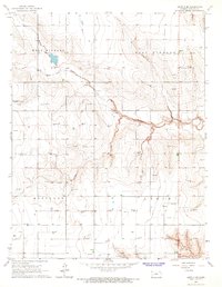
1966 Map of Leoti 3 SE
USGS Topo · Published 1967About this map
The High Plains of Kearny County, Kansas, are defined here by the deep incisions of Mattox Draw, which winds through the townships of West Hibbard and East Hibbard. This 1960s landscape reflects the intensive development of the Hugoton Gas Area, with numerous Gas Wells scattered across the upland plateaus. The topography is largely defined by the transition from the relatively flat boundaries of Hartland and Lakin into the drainage systems that feed the Arkansas River valley to the south. Small-scale industrial activity is evident in the presence of a Gravel Pit and Shale Pits, supporting local infrastructure. These features, combined with the extensive network of unimproved dirt roads, illustrate the specialized resource-extraction economy that shaped the rural character of western Kansas during the mid-20th century.
Find a feature on this map
9 named features on this map. Tap any name to fly to it.
Don’t see what you’re looking for? This feature index may not catch every label — zoom into the map to look around manually.
Map Details
Editions of this 1966 Leoti 3 SE Map
2 editions found
Other maps of this area

1891 · Larned
USGS Topo · 1:125,000

1900 · Lakin
USGS Topo · 1:125,000

1955 · Dodge City
USGS Topo · 1:250,000

1955 · Scott City
USGS Topo · 1:250,000

1958 · Dodge City
USGS Topo · 1:250,000

1958 · Scott City
USGS Topo · 1:250,000

1959 · Dodge City
USGS Topo · 1:250,000

1960 · Deerfield
USGS Topo · 1:24,000

1965 · Leoti 3 NW
USGS Topo · 1:24,000

1965 · Leoti 3 NE
USGS Topo · 1:24,000