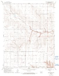
1966 Map of Mattox Draw SE
USGS Topo · Published 1993About this map
Mattox Draw carves a central path through this section of Kearny County, defining a landscape marked by the rise of the local energy and extraction industries during the mid-1960s. The map document is dominated by numerous Gas Wells and infrastructure developments across the townships of West Hibbard, East Hibbard, Hartland, and Lakin. This distribution of industrial points reveals a systematic pattern of resource exploration occurring just as photogrammetric methods were modernizing topographic survey accuracy. Evidence of local surface mining is also present, with a Gravel Pit located in the northwest and Shale Pits situated near the southern boundary, indicating the varied geological interests in the region during this era.
Find a feature on this map
8 named features on this map. Tap any name to fly to it.
Don’t see what you’re looking for? This feature index may not catch every label — zoom into the map to look around manually.
Map Details
Editions of this 1966 Mattox Draw SE Map
2 editions found
Other maps of this area

1891 · Larned
USGS Topo · 1:125,000

1900 · Lakin
USGS Topo · 1:125,000

1955 · Dodge City
USGS Topo · 1:250,000

1955 · Scott City
USGS Topo · 1:250,000

1958 · Dodge City
USGS Topo · 1:250,000

1958 · Scott City
USGS Topo · 1:250,000

1959 · Dodge City
USGS Topo · 1:250,000

1960 · Deerfield
USGS Topo · 1:24,000

1965 · Leoti 3 NW
USGS Topo · 1:24,000

1965 · Leoti 3 NE
USGS Topo · 1:24,000