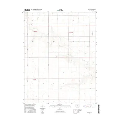
2015 Map of Leoti NW
USGS Topo · Published 2015About this map
White Woman Cr meanders across this High Plains landscape in western Kansas, carving a distinct drainage pattern through the townships of t18s r38w and t18s r37w. This 2015 survey illustrates a strictly organized agricultural grid, where the vast majority of human movement is defined by a network of sectional roads such as Co Rd 5 and Co RD 10. The terrain is characterized by subtle elevation shifts and numerous depressions, likely representing ephemeral catchments or playa lakes typical of the region's semi-arid environment. Far from major urban centers, the map documents the meticulous division of land into sections, highlighting the endurance of the Public Land Survey System. Local transportation relies on routes like Carter Rd and Co Rd V to connect the disparate farmsteads and fields that define Wichita County's rural economy.
Find a feature on this map
23 named features on this map. Tap any name to fly to it.
Don’t see what you’re looking for? This feature index may not catch every label — zoom into the map to look around manually.
Map Details
Editions of this 2015 Leoti NW Map
This is the sole edition of this map. No revisions or reprints were ever made.
Other maps of this area

1955 · Scott City
USGS Topo · 1:250,000

1958 · Scott City
USGS Topo · 1:250,000

1968 · Russell Springs 3 SW
USGS Topo · 1:24,000

1968 · Russell Springs 3 SE
USGS Topo · 1:24,000

1970 · Sharon Springs 4 SE
USGS Topo · 1:24,000

1970 · Selkirk SE
USGS Topo · 1:24,000

1970 · Selkirk
USGS Topo · 1:24,000

1970 · Leoti
USGS Topo · 1:24,000

1970 · Lydia
USGS Topo · 1:24,000

1970 · Leoti NW
USGS Topo · 1:24,000