
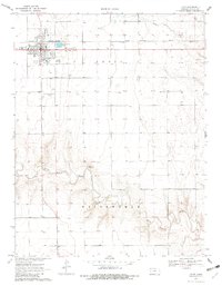
1970 Map of Leoti
USGS Topo · Published 1972About this map
Leoti serves as the focal point of this Wichita County landscape, established at the junction of local transit and the Missouri Pacific railroad. The town's layout reflects a self-sufficient prairie hub, containing a High Sch, a Fairground, and the Mark Hoard Memorial Airfield. Outside the primary grid, the settlement of Coronado and the County Cem are connected by a network of section roads that navigate the High Plains terrain.
Find a feature on this map
13 named features on this map. Tap any name to fly to it.
Don’t see what you’re looking for? This feature index may not catch every label — zoom into the map to look around manually.
Map Details
Editions of this 1970 Leoti Map
2 editions found
Other maps of this area

1939 · Pence
USGS Topo · 1:62,500

1941 · Modoc
USGS Topo · 1:62,500

1941 · Pence
USGS Topo · 1:62,500

1951 · Modoc
USGS Topo · 1:62,500

1955 · Scott City
USGS Topo · 1:250,000

1958 · Scott City
USGS Topo · 1:250,000

1968 · Russell Springs 3 SW
USGS Topo · 1:24,000

1968 · Russell Springs 3 SE
USGS Topo · 1:24,000

1970 · Lydia
USGS Topo · 1:24,000

1970 · Leoti NW
USGS Topo · 1:24,000