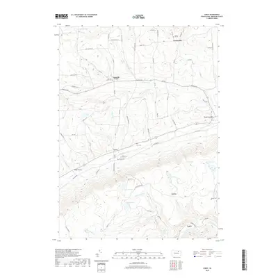
2019 Map of Leroy
USGS Topo · Published 2019About this map
Towanda Creek and its northern branch define the drainage of this Bradford County landscape, where small settlements like Leroy and West Leroy follow the valley floor. High-elevation family plots and community burying grounds, including the Mott Family Cem and the Vroman Hill Cem on Vroman Hill, provide essential data points for local genealogists. The southern portion of the map is dominated by a complex network of runs and ponds, such as Sunfish Pond, Holcomb Pond, and Mud Pond, which feed into Schrader Creek. This area shows a transition from the agricultural valleys near Granville Center to the more isolated creek hollows around Carbon and Laquin. The presence of the Swimming Dam on Coal Run suggests a landscape utilized for local recreation alongside the established rural road networks.
Find a feature on this map
86 named features on this map. Tap any name to fly to it.
Don’t see what you’re looking for? This feature index may not catch every label — zoom into the map to look around manually.
Map Details
Editions of this 2019 Leroy Map
This is the sole edition of this map. No revisions or reprints were ever made.
Other maps of this area

1931 · Troy
USGS Topo · 1:48,000

1938 · Troy
USGS Topo · 1:62,500

1939 · Sayre
USGS Topo · 1:62,500

1942 · Sayre
USGS Topo · 1:62,500

1942 · Canton
USGS Topo · 1:62,500

1943 · Powell
USGS Topo · 1:62,500

1944 · Canton
USGS Topo · 1:62,500

1945 · Powell
USGS Topo · 1:62,500

1948 · Sayre
USGS Topo · 1:62,500

1954 · Williamsport
USGS Topo · 1:250,000
Featured Places
- West Burlington Township, PA
- Leroy Township, PA
- Overton Township, PA
- West Leroy, Leroy Township
- Granville Township, PA