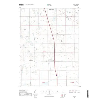
2019 Map of Leroy
USGS Topo · Published 2019About this map
Crown Point sits at the northern edge of this Lake County landscape, where the residential expansion of the city meets an extensive network of managed watercourses and rural settlements. Small communities like Leroy, Southeast Grove, and Orchard Grove mark the transition from suburban outskirts into the agricultural heart of the region. The map reveals a highly engineered hydrological system designed for prairie drainage, dominated by features such as Singleton Ditch, Griesel Ditch, and Ebert Ditch, which channel water across the flat terrain toward the southern reaches of the quadrangle.
Find a feature on this map
73 named features on this map. Tap any name to fly to it.
Don’t see what you’re looking for? This feature index may not catch every label — zoom into the map to look around manually.
Map Details
Editions of this 2019 Leroy Map
This is the sole edition of this map. No revisions or reprints were ever made.
Other maps of this area

1953 · Leroy
USGS Topo · 1:24,000

1953 · St. John
USGS Topo · 1:24,000

1953 · Palmer
USGS Topo · 1:24,000

1953 · Crown Point
USGS Topo · 1:24,000

1953 · Hebron
USGS Topo · 1:24,000

1953 · Lowell
USGS Topo · 1:24,000

1953 · Chicago
USGS Topo · 1:250,000

1957 · Chicago
USGS Topo · 1:250,000

1957 · DeMotte
USGS Topo · 1:24,000

1959 · Schneider
USGS Topo · 1:24,000