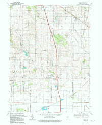
1992 Map of Leroy
USGS Topo · Published 1992About this map
Leroy sits at the intersection of a former Railroad Grade and a landscape transitioning from upland groves to a complex network of agricultural drainage. In the early 1990s, this area of Lake County reflects a deeply rooted rural layout where small settlements like Southeast Grove, Creston, and Dinwiddie are connected by a rigid grid of numbered avenues. The southern half of the map is defined by the managed water of the Little Ditch and Grisel Ditch systems, which suggest a history of reclaiming wetland for cultivation.
Find a feature on this map
39 named features on this map. Tap any name to fly to it.
Don’t see what you’re looking for? This feature index may not catch every label — zoom into the map to look around manually.
Map Details
Editions of this 1992 Leroy Map
This is the sole edition of this map. No revisions or reprints were ever made.
Other maps of this area

1953 · Leroy
USGS Topo · 1:24,000

1953 · St. John
USGS Topo · 1:24,000

1953 · Palmer
USGS Topo · 1:24,000

1953 · Crown Point
USGS Topo · 1:24,000

1953 · Hebron
USGS Topo · 1:24,000

1953 · Lowell
USGS Topo · 1:24,000

1953 · Chicago
USGS Topo · 1:250,000

1957 · Chicago
USGS Topo · 1:250,000

1957 · DeMotte
USGS Topo · 1:24,000

1959 · Schneider
USGS Topo · 1:24,000