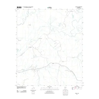
2012 Map of Lessley
USGS Topo · Published 2012About this map
Buffalo River meanders through the heart of this Wilkinson County landscape, defining a terrain shaped by both slow-moving water and the region's energy economy. In the early 21st century, the area around the settlement of Lessley shows a complex network of local roads and extraction sites, including the Alligator Bayou Oil Field, North Lessley Oil Field, and Pleasant Valley Oil Field. These industrial footprints are interspersed among traditional landmarks like the Courtney Cem and various watercourses such as Percy Cr and White Cr. Near the western edge, the presence of Foster Lake and Alligator Bayou reflects the lower-lying river bottom environment. The road network, from Woodlawn Rd to the Old Highway 24 Loop W, provides a look at the modern rural infrastructure and residential clusters that have developed around these historic family-named locations.
Find a feature on this map
42 named features on this map. Tap any name to fly to it.
Don’t see what you’re looking for? This feature index may not catch every label — zoom into the map to look around manually.
Map Details
Editions of this 2012 Lessley Map
This is the sole edition of this map. No revisions or reprints were ever made.
Other maps of this area

1936 · Woodville
USGS Topo · 1:62,500

1939 · Kingston
USGS Topo · 1:62,500

1939 · Artonish
USGS Topo · 1:62,500

1939 · Deer Park
USGS Topo · 1:62,500

1953 · Natchez
USGS Topo · 1:250,000

1954 · Artonish
USGS Topo · 1:62,500

1955 · Artonish
USGS Topo · 1:62,500

1956 · Natchez
USGS Topo · 1:250,000

1958 · Artonish
USGS Topo · 1:62,500

1958 · Woodville
USGS Topo · 1:62,500