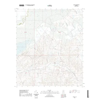
2020 Map of Lessley
USGS Topo · Published 2020About this map
Buffalo River and its intricate network of bayous and creeks dominate this southwest Mississippi landscape near the Adams and Wilkinson county line. The settlement of Lessley serves as a central point in a region defined by its hydrography, including the oxbow-like Lake Mary and Foster Lake to the west. This 2020 survey reveals a rural area where life is still oriented around the water, with Alligator Bayou and Dixons Bayou feeding into larger drainage systems.
Find a feature on this map
38 named features on this map. Tap any name to fly to it.
Don’t see what you’re looking for? This feature index may not catch every label — zoom into the map to look around manually.
Map Details
Editions of this 2020 Lessley Map
This is the sole edition of this map. No revisions or reprints were ever made.
Other maps of this area

1936 · Woodville
USGS Topo · 1:62,500

1939 · Kingston
USGS Topo · 1:62,500

1939 · Artonish
USGS Topo · 1:62,500

1939 · Deer Park
USGS Topo · 1:62,500

1953 · Natchez
USGS Topo · 1:250,000

1954 · Artonish
USGS Topo · 1:62,500

1955 · Artonish
USGS Topo · 1:62,500

1956 · Natchez
USGS Topo · 1:250,000

1958 · Artonish
USGS Topo · 1:62,500

1958 · Woodville
USGS Topo · 1:62,500