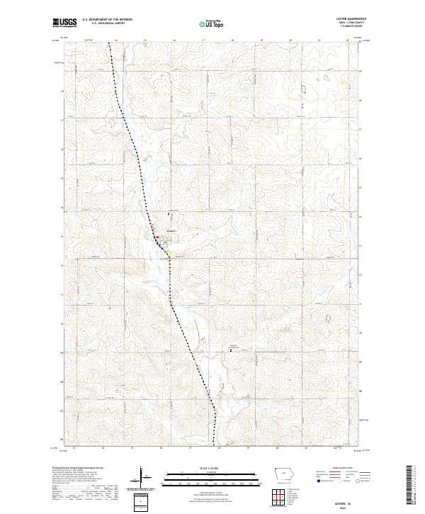
2022 Map of Lester
USGS Topo · Published 2022About this map
Lester anchors this corner of Lyon County, defined by its traditional Midwestern section-line grid and the meandering path of Mud Cr. The landscape is characterized by its organized agricultural layout, with prominent north-south transit routes like Eagle Ave and Dove Ave intersecting an extensive network of county highways and numbered streets. Genealogical interest centers on Hillside Cem just north of town and the Apostolic Christian Cem further south, reflecting the community's established local heritage. The layout of Iowa 9 St and the surrounding township boundaries of t100n r47w and t99n r46w provide a clear spatial record of this rural Iowa region's modern infrastructure and historical land divisions.
Find a feature on this map
34 named features on this map. Tap any name to fly to it.
Don’t see what you’re looking for? This feature index may not catch every label — zoom into the map to look around manually.
Map Details
Editions of this 2022 Lester Map
This is the sole edition of this map. No revisions or reprints were ever made.
Other maps of this area

1955 · Sioux Falls
USGS Topo · 1:250,000

1958 · Sioux Falls
USGS Topo · 1:250,000

1967 · Valley Springs
USGS Topo · 1:24,000

1967 · Hills
USGS Topo · 1:24,000

1967 · Ash Creek
USGS Topo · 1:24,000

1971 · Lester
USGS Topo · 1:24,000
1971 · Inwood
USGS Topo · 1:24,000
1971 · Larchwood
USGS Topo · 1:24,000

1971 · Rock Rapids
USGS Topo · 1:24,000

1971 · Doon
USGS Topo · 1:24,000