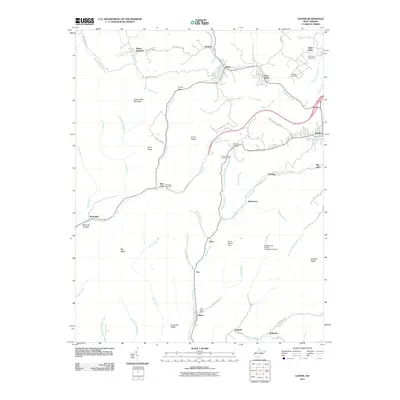
2011 Map of Lester
USGS Topo · Published 2011About this map
Guyandotte Mountain dominates the western topography of this Raleigh County region, where the steep hollows and ridges of the southern West Virginia coalfields dictate the pattern of settlement. Dense residential clusters follow the winding watercourses, notably along the Winding Gulf and Slab Fork drainage. Mining and industrial footprints are evident through features like the Riffe Branch Refuse Embankment Dam and the Berry Branch Dam. Historical communities such as Stotesbury, Tams, and Glen White are situated within these narrow valleys, while the town of Sophia serves as a more developed hub on the eastern edge. Industrial artifacts and landmarks including the Tams Mountain Lookout Tower and the curiously named Big Stick provide specific points of interest for local historians and researchers tracking the geography of the New River and Winding Gulf coalfields.
Find a feature on this map
72 named features on this map. Tap any name to fly to it.
Don’t see what you’re looking for? This feature index may not catch every label — zoom into the map to look around manually.
Map Details
Editions of this 2011 Lester Map
This is the sole edition of this map. No revisions or reprints were ever made.
Other maps of this area

1891 · Raleigh
USGS Topo · 1:125,000

1897 · Raleigh
USGS Topo · 1:125,000

1902 · Raleigh
USGS Topo · 1:125,000

1911 · Marshes
USGS Topo · 1:48,000

1911 · Flattop
USGS Topo · 1:48,000

1911 · Beckley
USGS Topo · 1:48,000

1912 · Mullens
USGS Topo · 1:62,500

1913 · Beckley
USGS Topo · 1:62,500

1914 · Eccles
USGS Topo · 1:62,500

1914 · Flattop
USGS Topo · 1:62,500