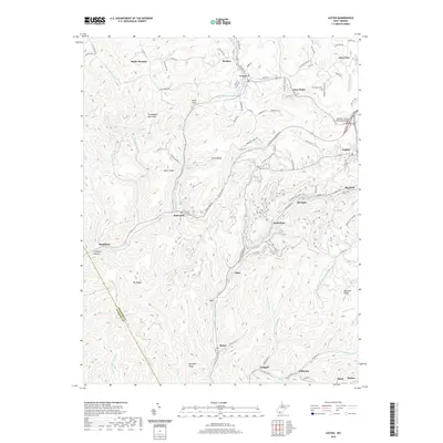
2019 Map of Lester
USGS Topo · Published 2019About this map
Guyandotte Mountain and Acord Ridge define the steep relief of this Raleigh County region, where coal-era settlements follow the winding paths of Slab Fork and Winding Gulf. The landscape is a dense network of valley communities, including Lester, Glen White, and Stotesbury, many of which were founded as company towns along the rail-dependent corridors of the southern West Virginia coalfields. The map highlights the proximity of neighboring camps like Tams, Helen, and Killarney, illustrating how the industry dictated the settlement pattern through narrow hollows like Slickrock Hollow. Beyond the industrial centers, local family history is anchored by features such as the Slab Fork Cem and natural landmarks like Hallie Basham Spring. Modern infrastructure, notably the Jeffrey S. Taylor Memorial Bridge near Sophia, connects these older mining hubs to contemporary transit routes, even as the terrain maintains its isolated character.
Find a feature on this map
108 named features on this map. Tap any name to fly to it.
Don’t see what you’re looking for? This feature index may not catch every label — zoom into the map to look around manually.
Map Details
Editions of this 2019 Lester Map
This is the sole edition of this map. No revisions or reprints were ever made.
Other maps of this area

1891 · Raleigh
USGS Topo · 1:125,000

1897 · Raleigh
USGS Topo · 1:125,000

1902 · Raleigh
USGS Topo · 1:125,000

1911 · Marshes
USGS Topo · 1:48,000

1911 · Flattop
USGS Topo · 1:48,000

1911 · Beckley
USGS Topo · 1:48,000

1912 · Mullens
USGS Topo · 1:62,500

1913 · Beckley
USGS Topo · 1:62,500

1914 · Eccles
USGS Topo · 1:62,500

1914 · Flattop
USGS Topo · 1:62,500