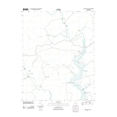
2011 Map of Lesterville SE
USGS Topo · Published 2011About this map
The Black River winds through this Iron County landscape, defining a valley carved with numerous named hollows and branches. In the early 21st century, the terrain remains deeply marked by the hydrology of the Ozarks, from the flow of Sinking Creek and Goose Creek to the widening waters of Whizenhunt Bay. This geography is a focal point for family history research, as the map records several small burial sites tucked into the hillsides, including Rutter Cemetery, Gulliams Cemetery, and Lewis Cemetery. Many of these features are located near old rural thoroughfares like Champion Spring Rd and Co Rd 338. The density of named hollows such as Brawley Hollow, Carpenter Hollow, and Dafron Hollow suggests a long history of local land use and family-named landmarks that have persisted through generations in this part of Missouri.
Find a feature on this map
55 named features on this map. Tap any name to fly to it.
Don’t see what you’re looking for? This feature index may not catch every label — zoom into the map to look around manually.
Map Details
Editions of this 2011 Lesterville SE Map
This is the sole edition of this map. No revisions or reprints were ever made.
Other maps of this area

1926 · Des Arc
USGS Topo · 1:62,500

1929 · Des Arc
USGS Topo · 1:62,500

1932 · Piedmont
USGS Topo · 1:62,500

1935 · Piedmont
USGS Topo · 1:62,500

1943 · Ellington
USGS Topo · 1:62,500

1943 · Lesterville
USGS Topo · 1:62,500

1945 · Ellington
USGS Topo · 1:62,500

1946 · Lesterville
USGS Topo · 1:62,500

1949 · Rolla
USGS Topo · 1:250,000

1953 · Rolla
USGS Topo · 1:250,000