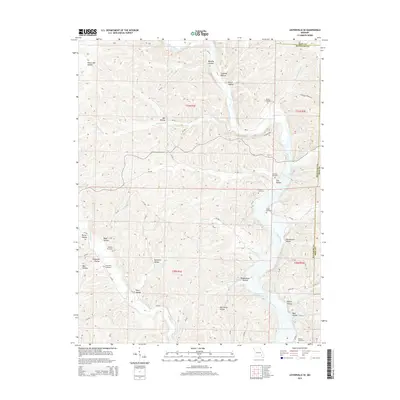
2015 Map of Lesterville SE
USGS Topo · Published 2015About this map
The Black River carves a winding path through this portion of the Missouri Ozarks, defining a landscape marked by deep hollows and family burial grounds. Along the river’s course, smaller tributaries like Goose Cr and Sinking Cr feed into the main channel, while notable points like Cave Spring and Whizenhunt Bay indicate the area's complex karst topography. The distribution of sites such as Rutter Cemetery, Gilliams Cemetery, and Mann Cemetery suggests long-established family homesteads scattered throughout the wooded hills and creek bottoms.
Find a feature on this map
58 named features on this map. Tap any name to fly to it.
Don’t see what you’re looking for? This feature index may not catch every label — zoom into the map to look around manually.
Map Details
Editions of this 2015 Lesterville SE Map
This is the sole edition of this map. No revisions or reprints were ever made.
Other maps of this area

1926 · Des Arc
USGS Topo · 1:62,500

1929 · Des Arc
USGS Topo · 1:62,500

1932 · Piedmont
USGS Topo · 1:62,500

1935 · Piedmont
USGS Topo · 1:62,500

1943 · Ellington
USGS Topo · 1:62,500

1943 · Lesterville
USGS Topo · 1:62,500

1945 · Ellington
USGS Topo · 1:62,500

1946 · Lesterville
USGS Topo · 1:62,500

1949 · Rolla
USGS Topo · 1:250,000

1953 · Rolla
USGS Topo · 1:250,000