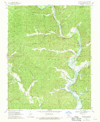
1969 Map of Lesterville SE
USGS Topo · Published 1971About this map
The Black River meanders through this portion of the Ozarks, carving a deep valley between the heights of Logan Mountain and the Lesterville hills. By the late 1960s, the landscape reflected a transition toward water management and recreation, with Whizenhunt Bay marking the northern reaches of the inundation area controlled by the Clearwater Dam. This controlled flooding has reshaped the traditional river bottomlands, where family-named landmarks like Rutter Cem and Guilliams Cem remain on higher ground. The map details a network of narrow hollows such as Coyote Hollow and Sycamore Hollow that feed into the main river system. Remote settlements like Mayberry and small family burial plots like Mann Cem and Hampton Cem provide significant points of interest for genealogists tracing the rural history of Reynolds County.
Find a feature on this map
39 named features on this map. Tap any name to fly to it.
Don’t see what you’re looking for? This feature index may not catch every label — zoom into the map to look around manually.
Map Details
Editions of this 1969 Lesterville SE Map
This is the sole edition of this map. No revisions or reprints were ever made.
Other maps of this area

1926 · Des Arc
USGS Topo · 1:62,500

1929 · Des Arc
USGS Topo · 1:62,500

1932 · Piedmont
USGS Topo · 1:62,500

1935 · Piedmont
USGS Topo · 1:62,500

1943 · Ellington
USGS Topo · 1:62,500

1943 · Lesterville
USGS Topo · 1:62,500

1945 · Ellington
USGS Topo · 1:62,500

1946 · Lesterville
USGS Topo · 1:62,500

1949 · Rolla
USGS Topo · 1:250,000

1953 · Rolla
USGS Topo · 1:250,000