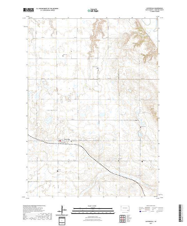
2021 Map of Lesterville
USGS Topo · Published 2021About this map
Lesterville serves as the central hub of this Yankton County landscape, where the rectilinear grid of section roads meets the winding course of the James River in the northeast corner. The settlement pattern is defined by a dense network of family and community landmarks, most notably a high concentration of historic burial grounds that speak to the area's pioneer heritage. From the Odessa Cem and Hoffnung Cem in the north to the Civil Cem and Klasi Cem further south, these sites anchor the rural townships. The southern reaches are drained by Beaver Cr, which meanders through the farmland south of Railroad St. This modern survey documents the persistent agricultural character of the region, preserving the exact locations of many small, scattered cemeteries such as Mueller Cem and Beadleston Cem that might otherwise be overlooked in broader geographic studies.
Find a feature on this map
34 named features on this map. Tap any name to fly to it.
Don’t see what you’re looking for? This feature index may not catch every label — zoom into the map to look around manually.
Map Details
Editions of this 2021 Lesterville Map
This is the sole edition of this map. No revisions or reprints were ever made.
Other maps of this area

1898 · Olivet
USGS Topo · 1:125,000

1898 · Parker
USGS Topo · 1:125,000

1955 · Sioux City
USGS Topo · 1:250,000

1955 · Sioux Falls
USGS Topo · 1:250,000

1957 · Midway
USGS Topo · 1:24,000

1957 · Menno
USGS Topo · 1:24,000

1957 · Jamesville
USGS Topo · 1:24,000

1957 · Scotland
USGS Topo · 1:24,000

1958 · Sioux City
USGS Topo · 1:250,000

1958 · Sioux Falls
USGS Topo · 1:250,000
Featured Places
- Lesterville, SD
- Odessa Township, SD
- Lesterville Township, SD
- Central Township, SD
- Jamesville Township, SD