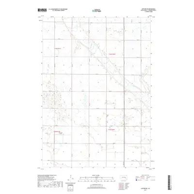
2017 Map of Letcher NE
USGS Topo · Published 2017About this map
The James River snakes through the glacial landscape of Sanborn County, creating a corridor of wetlands and oxbows amidst the structured grid of the American heartland. This 2017 survey of Union Township reveals a landscape dominated by agriculture, where section lines are strictly defined by roads such as 234th ST and 242nd ST. The meandering path of the river stands in stark contrast to the rigid geometry of the surrounding fields, illustrating the persistent influence of natural hydrology on local land use. Local history is anchored by the Butler Cem, a small burial ground located south of 238th ST, which serves as a quiet record of the area's early families. Transportation in the region is facilitated by a network of county routes, including Co Hwy 21 and Co Hwy 29, while the MJ Aviation Airport north of Co Rd 8 highlights the modern connectivity of this rural prairie district.
Find a feature on this map
21 named features on this map. Tap any name to fly to it.
Don’t see what you’re looking for? This feature index may not catch every label — zoom into the map to look around manually.
Map Details
Editions of this 2017 Letcher NE Map
This is the sole edition of this map. No revisions or reprints were ever made.
Other maps of this area

1898 · Huron
USGS Topo · 1:125,000

1899 · Mitchell
USGS Topo · 1:125,000

1899 · Alexandria
USGS Topo · 1:125,000

1899 · De Smet
USGS Topo · 1:125,000

1953 · Huron
USGS Topo · 1:250,000

1953 · Watertown
USGS Topo · 1:250,000

1954 · Huron
USGS Topo · 1:250,000

1955 · Sioux Falls
USGS Topo · 1:250,000

1955 · Mitchell
USGS Topo · 1:250,000

1957 · Farwell NW
USGS Topo · 1:24,000