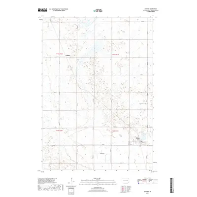
2017 Map of Letcher
USGS Topo · Published 2017About this map
Letcher serves as the primary hub in this corner of Sanborn County, where the grid of section lines meets the natural contours of the South Dakota prairie. The town is situated near the shores of Letcher Lake and is anchored by civic sites including Saint Scholastica Cem and West Lawn Cem along Co Rd 80. To the northwest, the small settlement of Cuthbert sits along the intersection of Co Rd 7 and 399th Ave, illustrating the sparse, agricultural nature of the region's development. The landscape is defined by its drainage patterns, notably the path of Dry Run winding through the western sections and the presence of Long Lake at the northern edge. This survey documents the modern road network, from local connectors like Johnson Rd to the established corridor of Co Hwy 2.
Find a feature on this map
31 named features on this map. Tap any name to fly to it.
Don’t see what you’re looking for? This feature index may not catch every label — zoom into the map to look around manually.
Map Details
Editions of this 2017 Letcher Map
This is the sole edition of this map. No revisions or reprints were ever made.
Other maps of this area

1898 · Huron
USGS Topo · 1:125,000

1899 · Mitchell
USGS Topo · 1:125,000

1953 · Huron
USGS Topo · 1:250,000

1954 · Huron
USGS Topo · 1:250,000

1955 · Mitchell
USGS Topo · 1:250,000

1957 · Loomis
USGS Topo · 1:24,000
1957 · Forestburg
USGS Topo · 1:24,000

1957 · Letcher NE
USGS Topo · 1:24,000

1959 · Mitchell
USGS Topo · 1:250,000
1973 · Forestburg SW
USGS Topo · 1:24,000