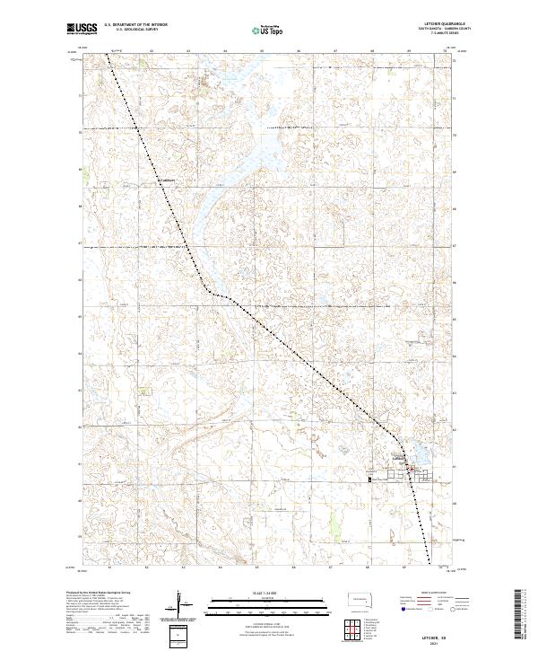
2021 Map of Letcher
USGS Topo · Published 2021About this map
Letcher serves as the primary hub of this eastern South Dakota landscape, where the local street grid centers on W Main St and Main St. The town is flanked by essential community markers, including Letcher Lake to the north and the West Lawn Cem and Saint Scholastica Cem to the south. This arrangement reflects the classic agrarian settlement pattern of Sanborn County, with small towns supporting a wide network of rural farmsteads connected by a precise grid of section-line roads.
Find a feature on this map
25 named features on this map. Tap any name to fly to it.
Don’t see what you’re looking for? This feature index may not catch every label — zoom into the map to look around manually.
Map Details
Editions of this 2021 Letcher Map
This is the sole edition of this map. No revisions or reprints were ever made.
Other maps of this area

1898 · Huron
USGS Topo · 1:125,000

1899 · Mitchell
USGS Topo · 1:125,000

1953 · Huron
USGS Topo · 1:250,000

1954 · Huron
USGS Topo · 1:250,000

1955 · Mitchell
USGS Topo · 1:250,000

1957 · Loomis
USGS Topo · 1:24,000
1957 · Forestburg
USGS Topo · 1:24,000

1957 · Letcher NE
USGS Topo · 1:24,000

1959 · Mitchell
USGS Topo · 1:250,000
1973 · Forestburg SW
USGS Topo · 1:24,000