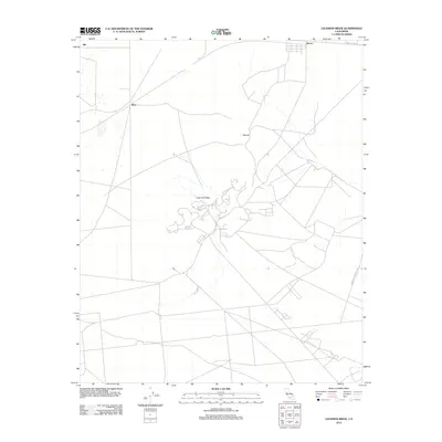
2012 Map of Leuhman Ridge
USGS Topo · Published 2012About this map
Boron sits at the northern edge of this high desert terrain, serving as a gateway to an area defined by specialized geological features and early-21st-century military activity. The landscape is marked by the presence of the Edwards Air Force Sta, which occupies a significant portion of the southern quadrant, reflecting the enduring role of defense installations in the region. Transportation patterns are anchored by the legendary 20 Mule Team Rd, a name that evokes the mining heritage of the Mojave despite the map's modern technical standards. Smaller settlements like Rich and Silt appear alongside natural landmarks such as Leuhman Ridge and the Mound, providing clear spatial reference points for the network of secondary roads and local routes that traverse the arid flats and low ridges.
Find a feature on this map
8 named features on this map. Tap any name to fly to it.
Don’t see what you’re looking for? This feature index may not catch every label — zoom into the map to look around manually.
Map Details
Editions of this 2012 Leuhman Ridge Map
This is the sole edition of this map. No revisions or reprints were ever made.
Other maps of this area

1915 · Searles Lake
USGS Topo · 1:250,000

1937 · Kramer
USGS Topo · 1:48,000

1937 · Rogers Lake
USGS Topo · 1:48,000

1942 · Kramer
USGS Topo · 1:62,500

1942 · Rogers Lake
USGS Topo · 1:62,500

1943 · Castle Butte
USGS Topo · 1:62,500

1947 · Castle Butte
USGS Topo · 1:50,000

1947 · Kramer
USGS Topo · 1:24,000

1947 · Johannesburg SE
USGS Topo · 1:25,000

1947 · Rich
USGS Topo · 1:24,000