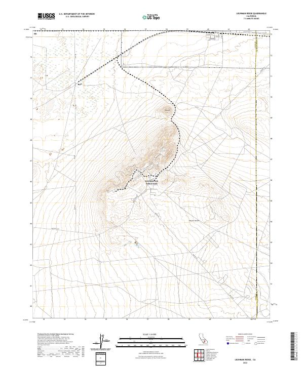
2022 Map of Leuhman Ridge
USGS Topo · Published 2022About this map
Leuhman Ridge rises as a prominent central spine in this section of the Mojave Desert, surrounded by the wide desert floor and specialized naming conventions reflecting the aerospace and mineral heritage of the region. Localized settlements like Rich and Silt appear near the northern edge of the survey, while the landscape is punctuated by distinct geological features such as the Mound. The transportation network is notably defined by roads with celestial and industrial names, including Mercury Blvd and Mars Blvd. Along the northeastern corner, the historic Twenty Mule Team Rd follows the border between Kern and San Bernardino Counties, tracing the path of the famous mineral haulage routes that once connected remote mining operations to the railhead.
Find a feature on this map
23 named features on this map. Tap any name to fly to it.
Don’t see what you’re looking for? This feature index may not catch every label — zoom into the map to look around manually.
Map Details
Editions of this 2022 Leuhman Ridge Map
This is the sole edition of this map. No revisions or reprints were ever made.
Other maps of this area

1915 · Searles Lake
USGS Topo · 1:250,000

1937 · Kramer
USGS Topo · 1:48,000

1937 · Rogers Lake
USGS Topo · 1:48,000

1942 · Kramer
USGS Topo · 1:62,500

1942 · Rogers Lake
USGS Topo · 1:62,500

1943 · Castle Butte
USGS Topo · 1:62,500

1947 · Castle Butte
USGS Topo · 1:50,000

1947 · Kramer
USGS Topo · 1:24,000

1947 · Johannesburg SE
USGS Topo · 1:25,000

1947 · Rich
USGS Topo · 1:24,000