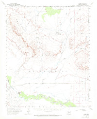
1955 Map of Leupp
USGS Topo · Published 1971About this map
The Little Colorado River winds through the southern portion of this landscape, defining the geographic orientation for the settlement of Leupp. Surveyed in the mid-1950s, the map illustrates a network of ephemeral watercourses including Oraibi Wash, Polacca Wash, and Canyon Diablo Wash that carve through the high desert terrain. The area is dominated by the massive landforms of Newberry Mesa and a smaller Mesa, highlighting the distinctive topography of the Navajo Indian Reservation.
Find a feature on this map
25 named features on this map. Tap any name to fly to it.
Don’t see what you’re looking for? This feature index may not catch every label — zoom into the map to look around manually.
Map Details
Editions of this 1955 Leupp Map
2 editions found

Other maps of this area

1883 · Tusayan
USGS Topo · 1:250,000

1886 · Tusayan
USGS Topo · 1:250,000

1886 · San Francisco Mtns
USGS Topo · 1:250,000

1891 · San Francisco Mtns
USGS Topo · 1:250,000

1894 · San Francisco Mtns
USGS Topo · 1:250,000

1899 · San Francisco Mtns
USGS Topo · 1:250,000

1947 · Flagstaff
USGS Topo · 1:250,000

1954 · Winslow
USGS Topo · 1:62,500

1954 · Winslow 4 NW
USGS Topo · 1:24,000

1954 · Flagstaff
USGS Topo · 1:250,000