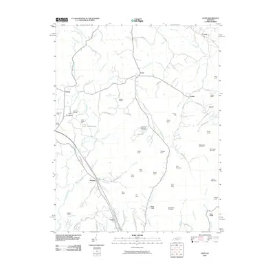
2010 Map of Levee
USGS Topo · Published 2010About this map
Indian Old Fields and the surrounding plateau dominate the western edge of this Montgomery County landscape, where the headwaters of Lulbegrud Creek and Brush Creek have carved a complex network of knobs and ridges. The 2010 survey shows a region defined by scattered rural settlements like Levee, Camargo, and Westbend, connected by narrow winding roads such as Old Winchester Rd and Hog Creek Rd.
Find a feature on this map
83 named features on this map. Tap any name to fly to it.
Don’t see what you’re looking for? This feature index may not catch every label — zoom into the map to look around manually.
Map Details
Editions of this 2010 Levee Map
This is the sole edition of this map. No revisions or reprints were ever made.
Other maps of this area

1892 · Richmond
USGS Topo · 1:125,000

1892 · Beattyville
USGS Topo · 1:125,000

1897 · Richmond
USGS Topo · 1:125,000

1950 · Levee
USGS Topo · 1:24,000

1952 · Preston
USGS Topo · 1:24,000

1952 · Palmer
USGS Topo · 1:24,000

1952 · Clay City
USGS Topo · 1:24,000

1952 · Mount Sterling
USGS Topo · 1:24,000

1952 · Stanton
USGS Topo · 1:24,000

1952 · Means
USGS Topo · 1:24,000