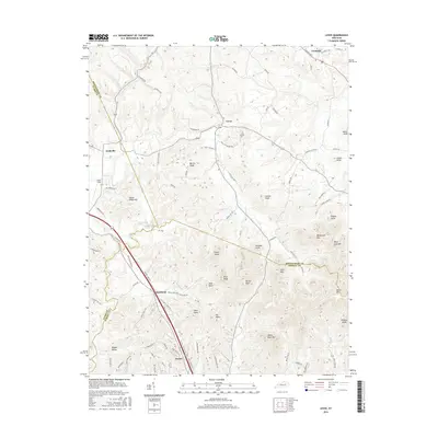
2016 Map of Levee
USGS Topo · Published 2016About this map
The community of Camargo sits at the northern edge of a landscape defined by sharp elevation changes where the plateau meets the knobs. This central Kentucky terrain is punctuated by significant rises such as Indian Fields Hill and Barlow Ridge, creating a jagged topography that has historically dictated the path of travel and settlement. Rural life centers around small clusters like Levee, Kiddville, and Westbend, connected by a network of winding roads like Camargo Levee Rd and Oldham Rd that follow the contours of the land.
Find a feature on this map
86 named features on this map. Tap any name to fly to it.
Don’t see what you’re looking for? This feature index may not catch every label — zoom into the map to look around manually.
Map Details
Editions of this 2016 Levee Map
This is the sole edition of this map. No revisions or reprints were ever made.
Other maps of this area

1892 · Richmond
USGS Topo · 1:125,000

1892 · Beattyville
USGS Topo · 1:125,000

1897 · Richmond
USGS Topo · 1:125,000

1950 · Levee
USGS Topo · 1:24,000

1952 · Preston
USGS Topo · 1:24,000

1952 · Palmer
USGS Topo · 1:24,000

1952 · Clay City
USGS Topo · 1:24,000

1952 · Mount Sterling
USGS Topo · 1:24,000

1952 · Stanton
USGS Topo · 1:24,000

1952 · Means
USGS Topo · 1:24,000