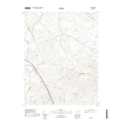
2019 Map of Levee
USGS Topo · Published 2019About this map
Camargo and the rural community of Levee serve as focal points for this region where the drainage basins of Lulbegrud Creek and Brush Creek meet. The landscape is defined by a dense network of knobs and ridges, including Grape Knob, Pilot Knob, and the prominent White Rock Mtn, which separate the agricultural valley floors from the more complex terrain of the Powell Co border. Transportation patterns are anchored by the Bert T Combs Mountain Parkway, which cuts through the southwestern sector near the settlement of Westbend. For those researching local history, the map provides detailed locations for familial sites such as Willoughby Cem and distinctive landmarks like Indian Fields Hill and Oldham Pond, illustrating how these small Kentucky communities have adapted to the limestone and sandstone uplands of the Cumberland Plateau's edge.
Find a feature on this map
115 named features on this map. Tap any name to fly to it.
Don’t see what you’re looking for? This feature index may not catch every label — zoom into the map to look around manually.
Map Details
Editions of this 2019 Levee Map
This is the sole edition of this map. No revisions or reprints were ever made.
Other maps of this area

1892 · Richmond
USGS Topo · 1:125,000

1892 · Beattyville
USGS Topo · 1:125,000

1897 · Richmond
USGS Topo · 1:125,000

1950 · Levee
USGS Topo · 1:24,000

1952 · Preston
USGS Topo · 1:24,000

1952 · Palmer
USGS Topo · 1:24,000

1952 · Clay City
USGS Topo · 1:24,000

1952 · Mount Sterling
USGS Topo · 1:24,000

1952 · Stanton
USGS Topo · 1:24,000

1952 · Means
USGS Topo · 1:24,000