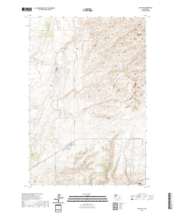
2023 Map of Levey SW
USGS Topo · Published 2023About this map
Juniper Dunes Wilderness dominates the northeast corner of this Franklin County landscape, marking a transition into a protected, arid environment north of the Snake River. The southern portion of the map is defined by the critical transit corridor of Pasco Kahlotus Road and the path of the Columbia Plateau State Park Trl, which follows a former rail grade across the high desert. This 2023 survey illustrates the intersection of modern agricultural needs and conservation, with family-named routes like Kruse Rd, Galloway Rd, and Samuel Brown Trail Rd providing access to isolated homesteads and ranching tracts. The geography is characterized by the winding Lower Smith Canyon and a network of gravel roads supporting local infrastructure, including the private Carr Airport.
Find a feature on this map
29 named features on this map. Tap any name to fly to it.
Don’t see what you’re looking for? This feature index may not catch every label — zoom into the map to look around manually.
Map Details
Editions of this 2023 Levey SW Map
This is the sole edition of this map. No revisions or reprints were ever made.
Other maps of this area

1915 · Wallulah
USGS Topo · 1:96,000

1917 · Pasco
USGS Topo · 1:125,000

1918 · Wallula
USGS Topo · 1:125,000

1953 · Walla Walla
USGS Topo · 1:250,000

1958 · Walla Walla
USGS Topo · 1:250,000

1963 · Rye Grass Coulee
USGS Topo · 1:24,000

1964 · Levey SW
USGS Topo · 1:24,000

1964 · Levey SE
USGS Topo · 1:24,000

1964 · Slater
USGS Topo · 1:24,000

1964 · Levey NE
USGS Topo · 1:24,000