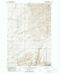
1991 Map of Levey SW
USGS Topo · Published 1992About this map
The Snake River corridor in Franklin County defines this landscape, where the massive infrastructure of the Ice Harbor Lock and Dam facilitates navigation and power generation. The interior terrain shows the complex water management systems of the era, notably the Eltopia Branch Canal and several pumping stations that support the region's agricultural transition. These engineered waterways contrast with the protected natural landscape of the Juniper Dunes Wilderness along the eastern margin.
Find a feature on this map
26 named features on this map. Tap any name to fly to it.
Don’t see what you’re looking for? This feature index may not catch every label — zoom into the map to look around manually.
Map Details
Editions of this 1991 Levey SW Map
This is the sole edition of this map. No revisions or reprints were ever made.
Other maps of this area

1915 · Wallulah
USGS Topo · 1:96,000

1917 · Pasco
USGS Topo · 1:125,000

1918 · Wallula
USGS Topo · 1:125,000

1953 · Walla Walla
USGS Topo · 1:250,000

1958 · Walla Walla
USGS Topo · 1:250,000

1963 · Rye Grass Coulee
USGS Topo · 1:24,000

1964 · Levey SW
USGS Topo · 1:24,000

1964 · Levey SE
USGS Topo · 1:24,000

1964 · Slater
USGS Topo · 1:24,000

1964 · Levey NE
USGS Topo · 1:24,000