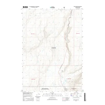
2015 Map of Lewis Canyon
USGS Topo · Published 2015About this map
Yellowstone National Park and the adjacent John D Rockefeller Junior Memorial Parkway meet in this 2015 study of the high-elevation terrain between the Lewis River and Snake River. The map highlights the area's hydrothermal activity, documenting specific locations like Phantom Fumarole and Crawfish Creek Hot Springs. The landscape is defined by its complex drainage network, where Polecat Cr, Spirea Cr, and Crawfish Cr flow through deep timber toward the dramatic Lewis Canyon.
Find a feature on this map
20 named features on this map. Tap any name to fly to it.
Don’t see what you’re looking for? This feature index may not catch every label — zoom into the map to look around manually.
Map Details
Editions of this 2015 Lewis Canyon Map
This is the sole edition of this map. No revisions or reprints were ever made.
Other maps of this area

1886 · Shoshone
USGS Topo · 1:125,000

1888 · Shoshone
USGS Topo · 1:125,000

1895 · Shoshone
USGS Topo · 1:125,000

1901 · Shoshone
USGS Topo · 1:125,000

1908 · Shoshone
USGS Topo · 1:125,000

1911 · Shoshone
USGS Topo · 1:125,000

1955 · Ashton
USGS Topo · 1:250,000
1956 · West Thumb
USGS Topo · 1:62,500

1956 · Old Faithful
USGS Topo · 1:62,500

1956 · Grassy Lake Reservoir
USGS Topo · 1:62,500