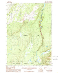
1989 Map of Lewis Canyon
USGS Topo · Published 1989About this map
Pitchstone Plateau dominates the northwestern landscape of this late-1980s survey, a high volcanic tableland within the borders of Yellowstone National Park. Geothermal activity is evident through labels for the Phantom Fumarole and several Hot Springs, illustrating the living geology of the region. The map tracks the steep descent of the Lewis River through the dramatic Lewis Canyon, eventually meeting the Snake River near the park's South Entrance.
Find a feature on this map
23 named features on this map. Tap any name to fly to it.
Don’t see what you’re looking for? This feature index may not catch every label — zoom into the map to look around manually.
Map Details
Editions of this 1989 Lewis Canyon Map
This is the sole edition of this map. No revisions or reprints were ever made.
Other maps of this area

1886 · Shoshone
USGS Topo · 1:125,000

1888 · Shoshone
USGS Topo · 1:125,000

1895 · Shoshone
USGS Topo · 1:125,000

1901 · Shoshone
USGS Topo · 1:125,000

1908 · Shoshone
USGS Topo · 1:125,000

1911 · Shoshone
USGS Topo · 1:125,000

1955 · Ashton
USGS Topo · 1:250,000
1956 · West Thumb
USGS Topo · 1:62,500

1956 · Old Faithful
USGS Topo · 1:62,500

1956 · Grassy Lake Reservoir
USGS Topo · 1:62,500