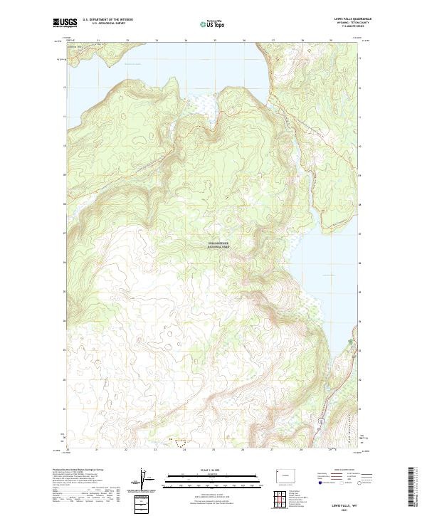
2021 Map of Lewis Falls
USGS Topo · Published 2021About this map
Yellowstone National Park is defined here by the high-elevation hydrology of the Continental Divide, where the headwaters of major river systems begin their descent. The map centers on the massive expanse of Shoshone Lake and the smaller Lewis Lake to the southeast, connected by the Lewis River Channel Trl. This landscape is a critical nexus for backcountry travel, as the Continental Divide National Scenic Trl winds through the central terrain, crossing over from the Moose Cr drainage.
Find a feature on this map
21 named features on this map. Tap any name to fly to it.
Don’t see what you’re looking for? This feature index may not catch every label — zoom into the map to look around manually.
Map Details
Editions of this 2021 Lewis Falls Map
This is the sole edition of this map. No revisions or reprints were ever made.
Other maps of this area

1886 · Shoshone
USGS Topo · 1:125,000

1888 · Shoshone
USGS Topo · 1:125,000

1895 · Shoshone
USGS Topo · 1:125,000

1901 · Shoshone
USGS Topo · 1:125,000

1908 · Shoshone
USGS Topo · 1:125,000

1911 · Shoshone
USGS Topo · 1:125,000

1955 · Ashton
USGS Topo · 1:250,000
1956 · West Thumb
USGS Topo · 1:62,500

1956 · Old Faithful
USGS Topo · 1:62,500

1956 · Grassy Lake Reservoir
USGS Topo · 1:62,500