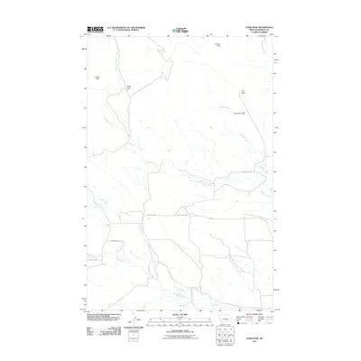
2011 Map of Lewis Peak
USGS Topo · Published 2011About this map
Lewis Peak and Lookout Peak anchor this high-relief landscape in Fergus County, where a network of ranch roads and drainages defines the local geography. The drainage patterns of Brickyard Creek and Edwards Creek demonstrate the complex hydrology of the area, while Ross Pass serves as a key topographic waypoint. Local ranching history is evidenced by named corridors like Richards Ranch Rd and Burnett Rd, which provide access through the gulches and foothills. The southern portion of the map is particularly concentrated with converging watercourses including Maiden Creek and Fords Creek, reflecting a terrain shaped by these seasonal and perennial flows between the larger peaks and named depressions like Log Gulch and Lone Tree Gulch.
Find a feature on this map
15 named features on this map. Tap any name to fly to it.
Don’t see what you’re looking for? This feature index may not catch every label — zoom into the map to look around manually.
Map Details
Editions of this 2011 Lewis Peak Map
This is the sole edition of this map. No revisions or reprints were ever made.
Other maps of this area

1941 · Judith Peak
USGS Topo · 1:62,500

1944 · Judith Peak
USGS Topo · 1:62,500

1954 · Lewistown
USGS Topo · 1:250,000

1959 · Lewistown
USGS Topo · 1:250,000

1978 · Lewistown
USGS Topo · 1:100,000

1985 · Fergus
USGS Topo · 1:24,000

1985 · Roy
USGS Topo · 1:24,000

1985 · Armells
USGS Topo · 1:24,000
1985 · Horsethief Coulee West
USGS Topo · 1:24,000
1985 · Judith Peak
USGS Topo · 1:24,000