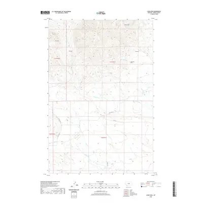
2020 Map of Lewis Peak
USGS Topo · Published 2020About this map
Lewis Peak and Lookout Peak dominate this landscape in Fergus County, where a network of seasonal streams and unpaved roads defines the high-altitude terrain. The drainage patterns of Brickyard Cr, Maiden Cr, and Fords Cr carve through the foothills, illustrating the complex hydrology of the region's ranching and wilderness areas. This modern topographical record shows a sparse but functional infrastructure, where Black Butte Rd and Fort Mcginnis Rd provide access through the mountain passes and deep valleys. For those studying land use and topography, the map detail captures the remote character of Ross Pass and the steep descents into Log Gulch and Lone Tree Gulch, preserving the spatial relationships between these named landmarks and the surrounding public and private lands.
Find a feature on this map
18 named features on this map. Tap any name to fly to it.
Don’t see what you’re looking for? This feature index may not catch every label — zoom into the map to look around manually.
Map Details
Editions of this 2020 Lewis Peak Map
This is the sole edition of this map. No revisions or reprints were ever made.
Other maps of this area

1941 · Judith Peak
USGS Topo · 1:62,500

1944 · Judith Peak
USGS Topo · 1:62,500

1954 · Lewistown
USGS Topo · 1:250,000

1959 · Lewistown
USGS Topo · 1:250,000

1978 · Lewistown
USGS Topo · 1:100,000

1985 · Fergus
USGS Topo · 1:24,000

1985 · Roy
USGS Topo · 1:24,000

1985 · Armells
USGS Topo · 1:24,000
1985 · Horsethief Coulee West
USGS Topo · 1:24,000
1985 · Judith Peak
USGS Topo · 1:24,000