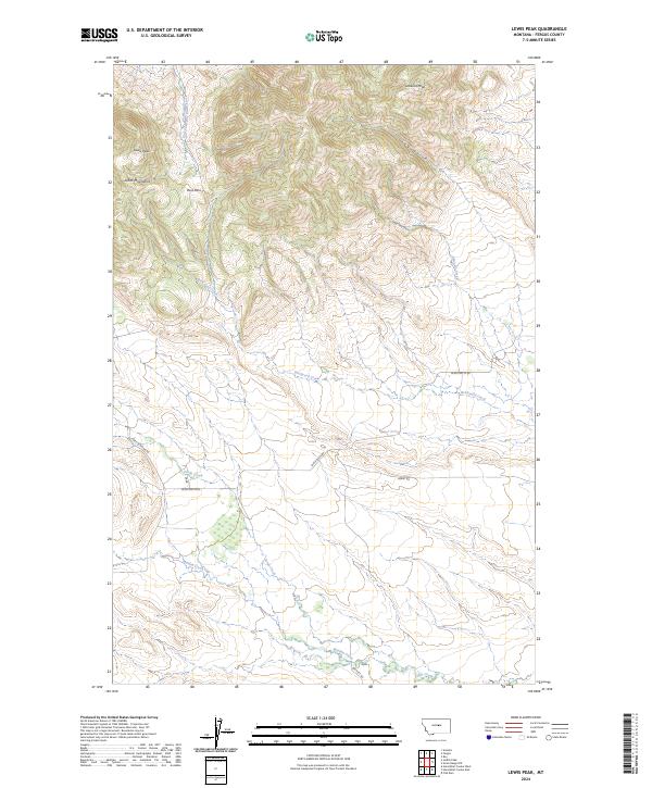
2024 Map of Lewis Peak
USGS Topo · Published 2024About this map
The Judith Mountains dominate the northwestern quadrant of this Fergus County landscape, with Lewis Peak and Lookout Peak anchoring the high ground. The terrain is deeply incised by drainages such as Log Gulch and Lone Tree Gulch, which feed into a complex hydraulic network including the East Fork Box Elder Creek and Edwards Creek. This topography creates natural corridors like Ross Pass, which historically influenced movement through the high country.
Find a feature on this map
19 named features on this map. Tap any name to fly to it.
Don’t see what you’re looking for? This feature index may not catch every label — zoom into the map to look around manually.
Map Details
Editions of this 2024 Lewis Peak Map
This is the sole edition of this map. No revisions or reprints were ever made.
Other maps of this area

1941 · Judith Peak
USGS Topo · 1:62,500

1944 · Judith Peak
USGS Topo · 1:62,500

1954 · Lewistown
USGS Topo · 1:250,000

1959 · Lewistown
USGS Topo · 1:250,000

1978 · Lewistown
USGS Topo · 1:100,000

1985 · Fergus
USGS Topo · 1:24,000

1985 · Roy
USGS Topo · 1:24,000

1985 · Armells
USGS Topo · 1:24,000
1985 · Horsethief Coulee West
USGS Topo · 1:24,000
1985 · Judith Peak
USGS Topo · 1:24,000