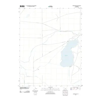
2010 Map of Lewis Ranch
USGS Topo · Published 2010About this map
Horse Creek Reservoir dominates this landscape in Otero County, serving as a vital hydrologic hub for regional agriculture. This early 21st-century survey details an intricate network of irrigation infrastructure designed to manage water in the high plains, including the Fort Lyon Storage Canal and the Horse Creek Supply Canal. The engineering of the Horse Creek Dam and its subsequent Horse Creek Reservoir Outlet Ditch illustrates the complexity of water rights and distribution in this arid environment.
Find a feature on this map
23 named features on this map. Tap any name to fly to it.
Don’t see what you’re looking for? This feature index may not catch every label — zoom into the map to look around manually.
Map Details
Editions of this 2010 Lewis Ranch Map
This is the sole edition of this map. No revisions or reprints were ever made.
Other maps of this area

1891 · Catlin
USGS Topo · 1:125,000

1891 · Las Animas
USGS Topo · 1:125,000

1893 · Las Animas
USGS Topo · 1:125,000

1893 · Catlin
USGS Topo · 1:125,000

1953 · Cheraw
USGS Topo · 1:24,000

1953 · Cornelia
USGS Topo · 1:24,000

1953 · Hadley
USGS Topo · 1:24,000

1954 · Meredith Hill
USGS Topo · 1:24,000

1954 · Lamar
USGS Topo · 1:250,000

1955 · Mc Intosh Ranch
USGS Topo · 1:24,000