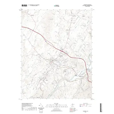
2019 Map of Lewisburg
USGS Topo · Published 2019About this map
Lewisburg serves as the focal point of this 2019 survey, showcasing a dense network of civic and historical sites including the Greenbrier County Courthouse and Greenbrier County Magistrate Court. The area is notably rich in genealogical sites, featuring the Old Stone Cem, Confederate Cem, and Rosewood Cem near the town center. The landscape is defined by the winding course of the Greenbrier River to the southeast, where the PFC Ralph E Pomeroy Memorial Bridge and Caldwell Bridge facilitate travel between North Caldwell and Caldwell. Significant elevations like Weaver Knob and Wagner Hill overlook the valley, while the northern reaches transition toward the Greenbrier Valley Airport and the community of Maxwelton. This modern topographical study captures the contemporary infrastructure surrounding these long-established settlements at the edge of the Allegheny Plateau.
Find a feature on this map
167 named features on this map. Tap any name to fly to it.
Don’t see what you’re looking for? This feature index may not catch every label — zoom into the map to look around manually.
Map Details
Editions of this 2019 Lewisburg Map
This is the sole edition of this map. No revisions or reprints were ever made.
Other maps of this area

1887 · Hinton
USGS Topo · 1:125,000

1887 · Lewisburg
USGS Topo · 1:125,000

1891 · Lewisburg
USGS Topo · 1:125,000

1892 · Hinton
USGS Topo · 1:125,000

1921 · Alderson
USGS Topo · 1:48,000

1921 · White Sulphur Springs
USGS Topo · 1:48,000

1921 · Clintonville
USGS Topo · 1:48,000

1921 · Ronceverte
USGS Topo · 1:48,000

1923 · Clintonville
USGS Topo · 1:62,500

1923 · White Sulphur Springs
USGS Topo · 1:62,500