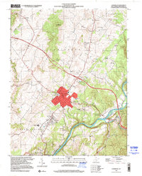
1998 Map of Lewisburg
USGS Topo · Published 2000About this map
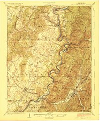
Lewisburg serves as the regional hub of Greenbrier County on this late-twentieth-century survey, surrounded by established settlements like Maxwelton, Fairlea, and Caldwell. The landscape is a mix of agricultural plateaus and prominent heights such as Weaver Knob and Wagner Hill, descending toward the winding Greenbrier River. Significant infrastructure of the era is evident, including the Greenbrier Valley Airport and the specialized Greenbrier Training Ctr near the town center. Local history and genealogy interest is concentrated in numerous country houses of worship, ranging from Calvary Ch in the north to the McClain Ch in the south. The presence of the Lost World Caverns and a Drive-in Theater reflects the area's development as a waypoint for travelers along the modern road network, while landmarks like Greenbrier Memorial Gardens and various family-named hills provide a detailed look at the local geography.
Find a feature on this map
44 named features on this map. Tap any name to fly to it.
Don’t see what you’re looking for? This feature index may not catch every label — zoom into the map to look around manually.
Map Details
Editions of this 1998 Lewisburg Map
This is the sole edition of this map. No revisions or reprints were ever made.
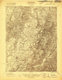
Other maps of this area

1887 · Hinton
USGS Topo · 1:125,000

1887 · Lewisburg
USGS Topo · 1:125,000

1891 · Lewisburg
USGS Topo · 1:125,000

1892 · Hinton
USGS Topo · 1:125,000

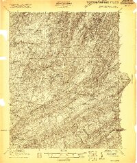
1921 · Alderson
USGS Topo · 1:48,000
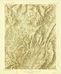
1921 · White Sulphur Springs
USGS Topo · 1:48,000

1921 · Clintonville
USGS Topo · 1:48,000
1921 · Ronceverte
USGS Topo · 1:48,000
1923 · Clintonville
USGS Topo · 1:62,500
1923 · White Sulphur Springs
USGS Topo · 1:62,500