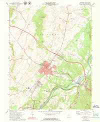
1972 Map of Lewisburg
USGS Topo · Published 1979About this map
Lewisburg serves as the regional hub in this 1970s survey, showing the city's established grid and its expansion toward Fairlea and the Greenbrier Valley Airport. The landscape is defined by the winding path of the Greenbrier River, where the Chesapeake and Ohio railroad tracks follow the water's edge through North Caldwell. A distinctive mix of karst topography and community development is evident, with Lost World Caverns located just north of the city center and various quarries dotting the outskirts.
Find a feature on this map
58 named features on this map. Tap any name to fly to it.
Don’t see what you’re looking for? This feature index may not catch every label — zoom into the map to look around manually.
Map Details
Editions of this 1972 Lewisburg Map
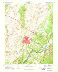
2 editions found
Other maps of this area

1887 · Hinton
USGS Topo · 1:125,000

1887 · Lewisburg
USGS Topo · 1:125,000

1891 · Lewisburg
USGS Topo · 1:125,000

1892 · Hinton
USGS Topo · 1:125,000

1921 · Alderson
USGS Topo · 1:48,000

1921 · White Sulphur Springs
USGS Topo · 1:48,000

1921 · Clintonville
USGS Topo · 1:48,000

1921 · Ronceverte
USGS Topo · 1:48,000

1923 · Clintonville
USGS Topo · 1:62,500

1923 · White Sulphur Springs
USGS Topo · 1:62,500