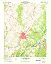
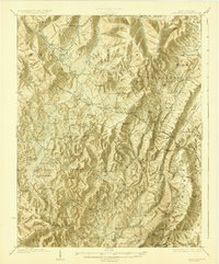
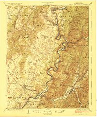
1972 Map of Lewisburg
USGS Topo · Published 1974About this map
The Greenbrier River defines the southern landscape of this 1972 survey, winding past the settlements of North Caldwell and Caldwell as it flows toward Ronceverte. The commercial and cultural heart of the region is centered on Lewisburg, where the town’s red-tinted urban core includes the local Library and the Greenbrier Training Center. The era’s transportation and recreation patterns are visible in the layout of the Greenbrier Valley Airport and the nearby Golf Course, while the northern hills hide the Lost World Caverns. Significant local landmarks like the Fairgrounds near Fairlea and the Arbuckle School serve as vital community anchors. The rail corridor of the Chesapeake and Ohio follows the riverbank, illustrating the historical reliance on this water-level route for regional transit and industry during the early 1970s.
Find a feature on this map
46 named features on this map. Tap any name to fly to it.
Don’t see what you’re looking for? This feature index may not catch every label — zoom into the map to look around manually.
Map Details
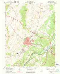
Editions of this 1972 Lewisburg Map
2 editions found
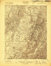
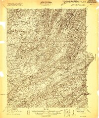
Other maps of this area

1887 · Hinton
USGS Topo · 1:125,000

1887 · Lewisburg
USGS Topo · 1:125,000

1891 · Lewisburg
USGS Topo · 1:125,000

1892 · Hinton
USGS Topo · 1:125,000

1921 · Alderson
USGS Topo · 1:48,000
1921 · White Sulphur Springs
USGS Topo · 1:48,000

1921 · Clintonville
USGS Topo · 1:48,000
1921 · Ronceverte
USGS Topo · 1:48,000
1923 · Clintonville
USGS Topo · 1:62,500
1923 · White Sulphur Springs
USGS Topo · 1:62,500