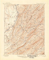
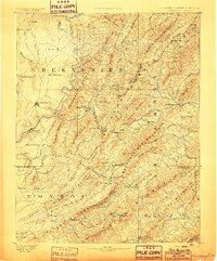
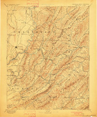
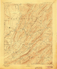
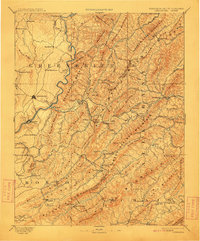
1891 Map of Lewisburg
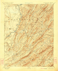
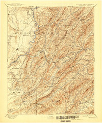
USGS Topo · Published 1948About this map
The Greenbrier River carves a deep valley through this 1880s landscape, serving as a primary corridor for both the Chesapeake and Ohio Railroad and early industrial settlements. The map highlights the region's historical importance as a spa destination, featuring well-known retreats like White Sulphur Springs and Sweet Chalybeate Spring. Significant civil engineering is evident along the rail line, most notably the Alleghany Tunnel and Lewis Tunnel where the tracks pierce the mountain ridges near Alleghany Station.
Find a feature on this map
131 named features on this map. Tap any name to fly to it.
Don’t see what you’re looking for? This feature index may not catch every label — zoom into the map to look around manually.
Map Details
Editions of this 1891 Lewisburg Map
8 editions found
Other maps of this area

1887 · Hinton
USGS Topo · 1:125,000

1887 · Lewisburg
USGS Topo · 1:125,000

1889 · Nicholas
USGS Topo · 1:125,000

1890 · Roanoke
USGS Topo · 1:125,000

1890 · Dublin
USGS Topo · 1:125,000

1890 · Christiansburg
USGS Topo · 1:125,000

1891 · Roanoke
USGS Topo · 1:125,000

1891 · Lewisburg
USGS Topo · 1:125,000

1891 · Nicholas
USGS Topo · 1:125,000

1891 · Huntersville
USGS Topo · 1:125,000