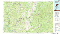
1984 Map of Lewisburg
USGS Topo · Published 1987About this map
Lewisburg and the surrounding Greenbrier Valley are depicted here during a period of infrastructure modernization, with the recently completed I-64 cutting across the landscape. This 1:100,000 scale survey captures the region's transition from traditional mineral spring resorts to a modern transportation hub. The map highlights the historic spa culture of the area, including White Sulphur Springs, Blue Sulphur Springs, and Salt Sulphur Springs, alongside established rail towns like Ronceverte.
Find a feature on this map
272 named features on this map. Tap any name to fly to it.
Don’t see what you’re looking for? This feature index may not catch every label — zoom into the map to look around manually.
Map Details
Editions of this 1984 Lewisburg Map
2 editions found
Other maps of this area

1887 · Pocahontas
USGS Topo · 1:125,000

1887 · Hinton
USGS Topo · 1:125,000

1887 · Lewisburg
USGS Topo · 1:125,000

1889 · Nicholas
USGS Topo · 1:125,000

1890 · Roanoke
USGS Topo · 1:125,000

1890 · Dublin
USGS Topo · 1:125,000

1890 · Christiansburg
USGS Topo · 1:125,000

1891 · Roanoke
USGS Topo · 1:125,000

1891 · Lewisburg
USGS Topo · 1:125,000

1891 · Nicholas
USGS Topo · 1:125,000