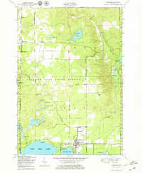
1950 Map of Lewiston
USGS Topo · Published 1979About this map
Lewiston and the surrounding timberlands of the Presque Isle State Forest are documented in this 1950 field check, revealing a landscape defined by glacial lakes and mid-century township infrastructure. The settlement at Lewiston serves as a local hub, featuring the Albert Township School, St Francis Church, and the Lewiston Cemetery near the northern shore of East Twin Lake. Further north, Vienna Junction and Vienna Corners mark early road intersections, with the Vienna Township Hall and Doubles School serving the rural population.
Find a feature on this map
62 named features on this map. Tap any name to fly to it.
Don’t see what you’re looking for? This feature index may not catch every label — zoom into the map to look around manually.
Map Details
Editions of this 1950 Lewiston Map
3 editions found
Other maps of this area

1949 · Lewiston
USGS Topo · 1:62,500

1950 · Lewiston
USGS Topo · 1:24,000

1950 · Comstock Hills
USGS Topo · 1:24,000

1950 · Johannesburg
USGS Topo · 1:24,000

1950 · Lovells
USGS Topo · 1:24,000

1951 · Comstock Hills
USGS Topo · 1:24,000

1951 · Lovells
USGS Topo · 1:24,000

1951 · Johannesburg
USGS Topo · 1:24,000

1951 · Lewiston
USGS Topo · 1:24,000

1954 · Hetherton
USGS Topo · 1:62,500