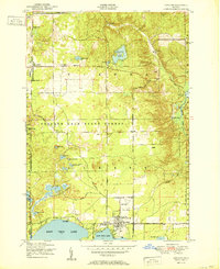
1951 Map of Lewiston
USGS Topo · Published 1951About this map
The timber-rich lands of the Presque Isle State Forest dominate this mid-century landscape, where the settlement of Lewiston serves as a hub for both local government and lakeside community life. Situated between West Twin Lake and East Twin Lake, the town is home to the Albert Township School, Bingham Park, and several houses of worship including St Francis Church and the First Congregational Community Church. To the north, the terrain is dotted with numerous kettle lakes and ponds such as Gaylanta Lake and Spectacle Lakes.
Find a feature on this map
53 named features on this map. Tap any name to fly to it.
Don’t see what you’re looking for? This feature index may not catch every label — zoom into the map to look around manually.
Map Details
Editions of this 1951 Lewiston Map
2 editions found
Other maps of this area

1949 · Lewiston
USGS Topo · 1:62,500

1950 · Lewiston
USGS Topo · 1:24,000

1950 · Comstock Hills
USGS Topo · 1:24,000

1950 · Johannesburg
USGS Topo · 1:24,000

1950 · Lovells
USGS Topo · 1:24,000

1951 · Comstock Hills
USGS Topo · 1:24,000

1951 · Lovells
USGS Topo · 1:24,000

1951 · Johannesburg
USGS Topo · 1:24,000

1951 · Lewiston
USGS Topo · 1:24,000

1954 · Hetherton
USGS Topo · 1:62,500