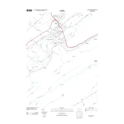
2013 Map of Lewistown
USGS Topo · Published 2013About this map
Lewistown serves as the central hub of this Pennsylvania landscape, where the Juniata River carves a winding path through the valley. The map documents a complex transport and industrial layout, from the railway infrastructure at Lewistown Junction to the residential corridors of Juniata Terrace and Highland Park. To the south and east, the terrain rises toward the ridges of the Appalachians, marked by the Shade Mountain Fire Tower and the deep cut of Bixler Gap. The area’s water resources are well-defined, including the Minehart Reservoir and Clearview Reservoir, alongside numerous runs and creeks like Kishacoquillas Cr and Jacks Cr. Smaller settlements and landmarks like Wagner Airport, Klondyke, and Martins Crossroads illustrate the mixed-use nature of Mifflin County, balancing urban density with protected forest lands and rural crossings.
Find a feature on this map
95 named features on this map. Tap any name to fly to it.
Don’t see what you’re looking for? This feature index may not catch every label — zoom into the map to look around manually.
Map Details
Editions of this 2013 Lewistown Map
This is the sole edition of this map. No revisions or reprints were ever made.
Other maps of this area

1919 · Mattawana
USGS Topo · 1:62,500

1924 · Lewistown
USGS Topo · 1:62,500

1925 · Mifflintown
USGS Topo · 1:48,000

1927 · Lewisburg
USGS Topo · 1:62,500

1930 · Loysville
USGS Topo · 1:62,500

1933 · Loysville
USGS Topo · 1:62,500

1934 · Mifflintown
USGS Topo · 1:62,500

1936 · East Waterford
USGS Topo · 1:48,000

1937 · Mifflintown
USGS Topo · 1:62,500

1941 · East Waterford
USGS Topo · 1:62,500