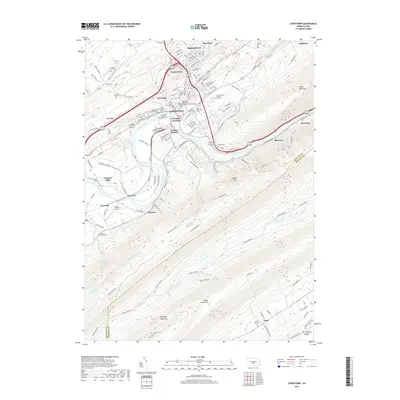
2019 Map of Lewistown
USGS Topo · Published 2019About this map
Lewistown serves as the hub of this landscape, situated where Kishacoquillas Creek meets the Juniata River. The town is characterized by a dense network of civic and religious institutions, including the Mifflin County Courthouse and numerous historic burial grounds such as the African Methodist Episcopal Cem and Saint Mark's Cem. The presence of the South Hills School of Business and Technology and the administrative center of the county highlight the area's role as a regional seat of education and governance.
Find a feature on this map
146 named features on this map. Tap any name to fly to it.
Don’t see what you’re looking for? This feature index may not catch every label — zoom into the map to look around manually.
Map Details
Editions of this 2019 Lewistown Map
This is the sole edition of this map. No revisions or reprints were ever made.
Other maps of this area

1919 · Mattawana
USGS Topo · 1:62,500

1924 · Lewistown
USGS Topo · 1:62,500

1925 · Mifflintown
USGS Topo · 1:48,000

1927 · Lewisburg
USGS Topo · 1:62,500

1930 · Loysville
USGS Topo · 1:62,500

1933 · Loysville
USGS Topo · 1:62,500

1934 · Mifflintown
USGS Topo · 1:62,500

1936 · East Waterford
USGS Topo · 1:48,000

1937 · Mifflintown
USGS Topo · 1:62,500

1941 · East Waterford
USGS Topo · 1:62,500