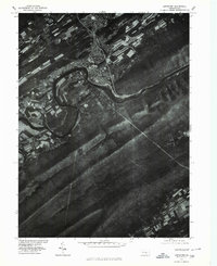
1977 Map of Lewistown
USGS Topo · Published 1979About this map
The Juniata River carves a deep, winding path through Mifflin County, dictating the development of Lewistown as it bends sharply to the south. This orthophotoquad reveals the intricate relationship between the town's urban grid and the natural corridor formed by the Kishcoquillas Creek confluence. To the south and east, the landscape is dominated by the heavy ridges of Shade Mountain and Blue Mountain, where the dense timber contrasts sharply with the agricultural patterns visible near Fairview. The imagery captures the valley's mid-century expansion, showing how residential and industrial footprints adjusted to the steep terrain and the creek beds, including the drainage of East Licking Creek as it passes through the mountain gaps.
Find a feature on this map
7 named features on this map. Tap any name to fly to it.
Don’t see what you’re looking for? This feature index may not catch every label — zoom into the map to look around manually.
Map Details
Editions of this 1977 Lewistown Map
This is the sole edition of this map. No revisions or reprints were ever made.
Other maps of this area

1919 · Mattawana
USGS Topo · 1:62,500

1924 · Lewistown
USGS Topo · 1:62,500

1925 · Mifflintown
USGS Topo · 1:48,000

1927 · Lewisburg
USGS Topo · 1:62,500

1930 · Loysville
USGS Topo · 1:62,500

1933 · Loysville
USGS Topo · 1:62,500

1934 · Mifflintown
USGS Topo · 1:62,500

1936 · East Waterford
USGS Topo · 1:48,000

1937 · Mifflintown
USGS Topo · 1:62,500

1941 · East Waterford
USGS Topo · 1:62,500