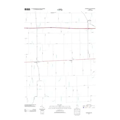
2013 Map of Lewisville
USGS Topo · Published 2013About this map
Lewisville and Straughn anchor this rural Henry County landscape, where the agricultural grid is defined by an extensive network of managed waterways and natural streams. The Flatrock River meanders through the western portion of the quadrangle, while a sophisticated drainage system including Glidden Ditch, Hall Ditch, and Prine Ditch supports the surrounding farmland. This modern survey reflects the enduring spatial organization of the Indiana countryside, where small towns are connected by straight section-line roads and the occasional bend of Applebutter Cr or N Fork Shawnee Cr. In the northern reaches, the New Castle-Henry County Municipal Airport sits near the small community of New Lisbon, illustrating the intersection of local aviation and traditional rural settlements. The map provides a clear view of the transition from early 19th-century village centers to contemporary infrastructure.
Find a feature on this map
70 named features on this map. Tap any name to fly to it.
Don’t see what you’re looking for? This feature index may not catch every label — zoom into the map to look around manually.
Map Details
Editions of this 2013 Lewisville Map
This is the sole edition of this map. No revisions or reprints were ever made.
Other maps of this area

1948 · Lewisville
USGS Topo · 1:24,000

1949 · New Castle West
USGS Topo · 1:24,000

1950 · New Castle East
USGS Topo · 1:24,000

1950 · Dunreith
USGS Topo · 1:24,000

1950 · Lewisville
USGS Topo · 1:24,000

1953 · Cincinnati
USGS Topo · 1:250,000

1956 · Connersville
USGS Topo · 1:24,000

1957 · Cincinnati
USGS Topo · 1:250,000

1959 · Mays
USGS Topo · 1:24,000

1959 · Falmouth
USGS Topo · 1:24,000